File:Yemeni Civil War.svg

Original file (SVG file, nominally 1,625 × 1,061 pixels, file size: 923 KB)
Captions
Captions
Summary
edit
|
This file may be updated to reflect new information. If you wish to use a specific version of the file without it being overwritten, please upload the required version as a separate file. |
| DescriptionYemeni Civil War.svg |
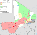
Català: Mapa detallat de l'insurgència al Iemen. Deutsch: Detaillierte Karte des Bürgerkriegs im Jemen. English: Insurgency in Yemen detailed Map according to published reports. This map's information is sometimes based on w:Module:Yemeni Civil War detailed map. For sources, see that page's history and talk page. For a visual representation of the data, see that module's documentation page. Español: Mapa detallado de la insurgencia en Yemen. Français : Conflit au Yémen, d'après une carte de Mark Monmonier. Italiano: Mappa dettagliata della situazione attuale in Yemen. Nederlands: Gedetailleerde kaart van de Jeministische Burgeroorlog (2015). Português: Insurgência no {{w:pt|Iémen}} mapa detalhado de acordo com relatórios publicados. Ελληνικά: Η κατάσταση στον Υεμενικό Εμφύλιο Πόλεμο, όπως έχει διαμορφωθεί σύμφωνα με δημοσιεύματα. Русский: Подробная карта мятежа в Йемене. Українська: Детальна мапа повстання в Ємені згідно з опублікованими доповідями. Інформація на цій карті частково взята з w:Module:Yemeni Civil War detailed map. Щоб переглянути джерела sources, перегляньте історію цієї сторінки і сторінку обговорення. Щоб побачити візуальну репрезентацію даних, see that module's documentation page. 한국어: 예멘 반란 상세지도. 日本語: イエメン内戦の勢力図。 اردو : یمنی خاناجنگی کی صورتحال. العربية : النزاع في اليمنː فارسی : نقشهٔ جزئیات درگیریهای جنگ داخلی یمن. |
||||
| Date | |||||
| Source |
The map image is based on Template:Yemeni Civil War detailed map. Used blank map :Yemen location map.svg Feb. 3, 2024 update sourced from this map: https://commons.wikimedia.org/wiki/File:Yemen2024.png Borysk5, CC BY-SA 4.0 |
||||
| Author | Ali Zifan | ||||
| Other versions |
Note: Comments "areas of activity" means that this is not territorial control is shown.
 |
||||
| SVG development InfoField | This W3C-invalid map was created with Adobe Illustrator.
|
Licensing
edit- You are free:
- to share – to copy, distribute and transmit the work
- to remix – to adapt the work
- Under the following conditions:
- attribution – You must give appropriate credit, provide a link to the license, and indicate if changes were made. You may do so in any reasonable manner, but not in any way that suggests the licensor endorses you or your use.
- share alike – If you remix, transform, or build upon the material, you must distribute your contributions under the same or compatible license as the original.
File history
Click on a date/time to view the file as it appeared at that time.
| Date/Time | Thumbnail | Dimensions | User | Comment | |
|---|---|---|---|---|---|
| current | 08:17, 3 February 2024 |  | 1,625 × 1,061 (923 KB) | HetmanTheResearcher (talk | contribs) | Sourced update, cited form STC Forces Move Farther into Abyan - The Yemen Review, September 2022. (n.d.). Sana’a Center for Strategic Studies. Retrieved February 3, 2024, from https://sanaacenter.org/the-yemen-review/september-2022/18808 |
| 20:40, 10 September 2023 |  | 1,625 × 1,061 (730 KB) | Borysk5 (talk | contribs) | corrected colors | |
| 09:12, 7 September 2023 |  | 1,625 × 1,061 (730 KB) | DaniCBP (talk | contribs) | Corrected south-eastern Hadramout (mistaken Hadrami Elite Forces with STC) | |
| 16:57, 6 September 2023 |  | 1,625 × 1,061 (731 KB) | DaniCBP (talk | contribs) | Updated to September 2023, changes in the south | |
| 07:53, 24 July 2023 |  | 1,625 × 1,061 (731 KB) | Abo Yemen (talk | contribs) | Reverted to version as of 16:05, 31 August 2022 (UTC): Hadhrami Elite Forces are not the STC, please see talk page | |
| 12:53, 9 October 2022 |  | 1,625 × 1,061 (737 KB) | Borysk5 (talk | contribs) | Southern forces captured Mahfad | |
| 13:55, 14 September 2022 |  | 1,625 × 1,061 (738 KB) | Borysk5 (talk | contribs) | Southern forces are on outskirs of Mahfad district and are clashing with AQAP in Wadi Omran | |
| 20:10, 13 September 2022 |  | 1,625 × 1,061 (738 KB) | Borysk5 (talk | contribs) | Updates: STc entered Al-Wadea, Mudiyah distrcits. Clashes with AQAP east of Mudiya and in Shabwah | |
| 08:54, 1 September 2022 |  | 1,625 × 1,061 (735 KB) | Borysk5 (talk | contribs) | Added south of Hadramaut as controlled by Hadrami Elite Forces allied with STC. Also added AQAP in Marib | |
| 16:05, 31 August 2022 |  | 1,625 × 1,061 (731 KB) | Borysk5 (talk | contribs) | Update: Southerners entered Lawdar |
You cannot overwrite this file.
File usage on Commons
More than 100 pages use this file. The following list shows the first 100 pages that use this file only. A full list is available.
- User:Hermes79
- User:Hermes7979
- User talk:967Bytes
- User talk:BlueHypercane761
- User talk:BurritoBazooka
- User talk:GamesDiscussion
- User talk:Kohelet
- User talk:Kumdano9
- User talk:Leo Kitbash28
- User talk:Libyanews247
- User talk:LightandDark2000
- User talk:Majed
- User talk:Michael2552
- User talk:Nykterinos
- User talk:Panam2014
- User talk:Pbfreespace3
- User talk:RokerHRO
- User talk:SomeGirl777
- User talk:Turnless
- User talk:Пэйнчик
- User talk:صفاء
- File:2013 Hama Offensive.svg
- File:2015 Latakia Frontlines.svg
- File:Aleppo Offensives 2015.svg
- File:Battle of Daraa City.svg
- File:Battle of Hasakah.svg
- File:Battle of Qamishli.svg
- File:Battle of Raqqa.svg
- File:Battle of Western Qalamoun.svg
- File:Battlefields in The Global War on Terror.svg
- File:Battlefields in The Global War on Terror - edit03.png
- File:Battlefields in The Global War on Terror - edit04.png
- File:Boko Haram insurgency map.svg
- File:Countries by soldier count.svg
- File:Deir ez-Zor clashes (2017).svg
- File:East Congo conflict map.svg
- File:GSPC map.png
- File:Iraqi Civil War map (2014–present).png
- File:Islamist insurgency in Nigeria.svg
- File:Lebanese insurgency.png
- File:Lebanese insurgency.svg
- File:Libyan Civil War.svg
- File:Libyan war final-fr.svg
- File:Map of Ongoing conflicts around the world.png
- File:Map of terror of the Islamic State (ad-Daula al-islāmiyya).png
- File:Mexico states map small war.PNG
- File:Mosul offensive (2015) map.png
- File:Number of Terrorist Incidents.png
- File:Ongoing Conflicts (1).png
- File:Ongoing conflicts around the world.svg
- File:Pakistan-Waziristan-Map.png
- File:Political map Afar triangle.png
- File:Rif Damashq.svg
- File:Siege of Homs Map.svg
- File:Sinai insurgency.svg
- File:Somali Civil War (2009-present).svg
- File:Southern Sudan Civil War.svg
- File:Syria and Iraq 2014-onward War map.png
- File:Syrian, Iraqi, and Lebanese insurgencies.png
- File:Syrian civil war.png
- File:Tadmur offensive (2015).jpg
- File:World2s.png
- File:Yemen war detailed map.png
- File:Саудовско-йеменский конфликт.png
- Template talk:Legend
- Category:2015 military intervention in Yemen
- Category:Attack
- Category:Battle of Aleppo
- Category:Battles of Syria
- Category:Battles of the Syrian Civil War
- Category:Civil wars
- Category:Conflicts
- Category:Conflicts by continent
- Category:Conflicts by country
- Category:Conflicts by type
- Category:Current civil wars maps
- Category:Feuds
- Category:Fights
- Category:Maps of Somali Civil War
- Category:Maps of conflicts
- Category:Maps of disputed territories
- Category:Maps of the 2014 pro-Russian unrest in Ukraine
- Category:Maps of the Demilitarized Zone of Korea
- Category:Maps of the War in Afghanistan (2001–2021)
- Category:Maps of wars
- Category:Military conflicts
- Category:Military maps of the world
- Category:Ongoing armed conflicts
- Category:Quarrels
- Category:Rebellions
- Category:Riots
- Category:Schisms
- Category:Syrian Civil War
- Category:Terrorism
- Category:Uprisings
- Category:War
- Category:War casualties
- Category:Warfare by type
- Category:Wars
- Category:Wars by type
View more links to this file.
File usage on other wikis
The following other wikis use this file:
- Usage on af.wikipedia.org
- Usage on ar.wikipedia.org
- دولة دمية
- التدخل العسكري في اليمن
- الحرب الأهلية اليمنية (2014–الآن)
- قالب:صندوق معلومات الحرب الأهلية اليمنية
- قالب:صندوق معلومات التدخل العسكري في اليمن
- الخط الزمني للتدخل العسكري في اليمن
- معركة نهم
- قائمة الجماعات المسلحة في الحرب الأهلية اليمنية
- معاملة المثليين في اليمن
- ضربات الطائرات المسيرة في اليمن
- مستخدم:بدر/حوثيون
- مستخدم:أبو العلاء العلوي/ملعب
- أزمة البحر الأحمر
- Usage on azb.wikipedia.org
- Usage on az.wikipedia.org
- Usage on ba.wikipedia.org
- Usage on be.wikipedia.org
- Usage on bg.wikipedia.org
- Usage on bn.wikipedia.org
- Usage on br.wikipedia.org
- Usage on bs.wikipedia.org
- Usage on ca.wikipedia.org
- Usage on ckb.wikipedia.org
- Usage on cs.wikipedia.org
- Usage on da.wikipedia.org
- Usage on de.wikipedia.org
- Usage on diq.wikipedia.org
- Usage on el.wikipedia.org
- Usage on en.wikipedia.org
- History of Yemen
- Puppet state
- List of non-international armed conflicts
- Yemen
- Talk:List of ongoing armed conflicts
- LGBTQ rights in Yemen
- Houthi movement
- South Yemen insurgency
- Al-Qaeda insurgency in Yemen
- User talk:Banak
- User talk:Spesh531/Archive 2016
- User:Kopiersperre
- Drone strikes in Yemen
- Yemeni civil war (2014–present)
- Saudi-led intervention in the Yemeni civil war
View more global usage of this file.
Metadata
This file contains additional information such as Exif metadata which may have been added by the digital camera, scanner, or software program used to create or digitize it. If the file has been modified from its original state, some details such as the timestamp may not fully reflect those of the original file. The timestamp is only as accurate as the clock in the camera, and it may be completely wrong.
| Width | 1625.1733 |
|---|---|
| Height | 1061.3334 |


