
Abu Musa: Difference between revisions
UrielAcosta (talk | contribs) Tags: Mobile edit Mobile web edit |
No edit summary |
||
| (38 intermediate revisions by 27 users not shown) | |||
| Line 1: | Line 1: | ||
{{Short description|Island near the entrance to the Strait of Hormuz}} |
{{Short description|Iranian Island near the entrance to the Strait of Hormuz}} |
||
{{About|an island in the Persian Gulf|other uses}} |
{{About|an island in the Persian Gulf|other uses}} |
||
{{Use dmy dates|date=August 2018}} |
{{Use dmy dates|date=August 2018}} |
||
{{Infobox islands |
{{Infobox islands |
||
| disputed |
| disputed = |
||
| name |
| name = Bu Musa |
||
| other_names |
| other_names = {{Unbulleted list|style=font-weight:normal|{{langx|fa|{{nq|بوموسی}}}}|{{langx|en|bumusa}}}} |
||
| |
| image_map = {{OSM Location map |
||
| coord={{Coord|26.093833|55.168358}} |
|||
| ⚫ | |||
| float=left| zoom =7 |
|||
| ⚫ | |||
| width = 300 | height = 300 |
|||
| ⚫ | |||
| shape1=circle |
|||
| ⚫ | |||
| shape-color1=blue |
|||
| ⚫ | |||
| shape-outline1=black |
|||
| ⚫ | |||
| mark-size1=14 |
|||
| ⚫ | |||
| |
| label1 = [[Abu Musa]] |
||
| mark-coord1 = {{Coord|25.876228956292707|55.03277459120973}} |
|||
| ⚫ | |||
| mark-title1 = [[Abu Musa]] |
|||
| label-pos1 = bottom |
|||
| ⚫ | |||
| auto-caption=1 |
|||
}} |
|||
| image_caption = |
|||
| ⚫ | |||
| ⚫ | |||
| ⚫ | |||
| ⚫ | |||
| ⚫ | |||
| ⚫ | |||
| highest_mount = Mount Halva |
|||
| ⚫ | |||
| country_admin_divisions_title = Province |
| country_admin_divisions_title = Province |
||
| country_admin_divisions |
| country_admin_divisions = [[Hormozgan Province|Hormozgan]] |
||
| country_largest_city |
| country_largest_city = Abu Musa |
||
| country_largest_city_population = 1,953 |
| country_largest_city_population = 1,953 |
||
| country1 |
| country1 = |
||
| country1_admin_divisions_title |
| country1_admin_divisions_title = |
||
| country1_admin_divisions |
| country1_admin_divisions = |
||
| population |
| population = 2,131 |
||
| population_as_of |
| population_as_of = 2012 |
||
| density_km2 |
| density_km2 = 166 |
||
}} |
}} |
||
{{Infobox lighthouse |
{{Infobox lighthouse |
||
| qid = Q33412878 |
| qid = Q33412878 |
||
| mapframe-zoom = 8 |
| mapframe-zoom = 8 |
||
| map |
|||
| construction = Masonry Tower |
| construction = Masonry Tower |
||
| shape = square short tower atop building<ref>{{Cite rowlett|irn|accessdate=2016-10-03}}</ref><ref>[http://msi.nga.mil/NGAPortal/MSI.portal?_nfpb=true&_st=&_pageLabel=msi_pub_detail&CCD_itemID=112&pubConstant=NGALOL NGA List of Lights – Pub.112] {{Webarchive|url=https://web.archive.org/web/20161021203954/http://msi.nga.mil/NGAPortal/MSI.portal?_nfpb=true&_st=&_pageLabel=msi_pub_detail&CCD_itemID=112&pubConstant=NGALOL |date=21 October 2016 }} Retrieved 3 October 2016</ref> |
| shape = square short tower atop building<ref>{{Cite rowlett|irn|accessdate=2016-10-03}}</ref><ref>[http://msi.nga.mil/NGAPortal/MSI.portal?_nfpb=true&_st=&_pageLabel=msi_pub_detail&CCD_itemID=112&pubConstant=NGALOL NGA List of Lights – Pub.112] {{Webarchive|url=https://web.archive.org/web/20161021203954/http://msi.nga.mil/NGAPortal/MSI.portal?_nfpb=true&_st=&_pageLabel=msi_pub_detail&CCD_itemID=112&pubConstant=NGALOL |date=21 October 2016 }} Retrieved 3 October 2016</ref> |
||
}} |
}} |
||
[[File:Strait of hormuz.jpg|left|thumb|A map dated 1891 showing Abu Musa.]] |
[[File:Strait of hormuz.jpg|left|thumb|A map dated 1891 showing Abu Musa.]] |
||
| ⚫ | '''Abu Musa''' ({{langx|fa|بوموسا}} {{audio|Abu Musa pronounce.ogg|listen}}, {{IPA|fa|æbu mu'sɒ|IPA}}, {{langx|ar|أبو موسى}}) is an Iranian {{convert|12.8|km2|adj=on}} [[island]] in the eastern [[Persian Gulf]], found near the entrance of [[Strait of Hormuz]].<ref>[http://www.iranian.ws/cgi-bin/iran_news/exec/view.cgi/2/2358 Iranian Islands of Tunbs and Abu Musa] {{webarchive |url=https://web.archive.org/web/20060923072835/http://www.iranian.ws/cgi-bin/iran_news/exec/view.cgi/2/2358 |date=23 September 2006 }}</ref> Due to the depth of sea, oil tankers and big ships have to pass between Abu Musa and [[Greater and Lesser Tunbs]], making these islands some of the most strategic points in the Persian Gulf.<ref name="AndersonOwen1993">{{cite book |
||
| ⚫ | '''Abu Musa''' ({{ |
||
|author1 = Ewan W. Anderson |
|author1 = Ewan W. Anderson |
||
|author2 = Gareth Owen |
|author2 = Gareth Owen |
||
| Line 48: | Line 62: | ||
|archive-date = 30 May 2016 |
|archive-date = 30 May 2016 |
||
|url-status = live |
|url-status = live |
||
}}</ref> The island is |
}}</ref> The island is under the administration of [[Iran]], as part of the [[Hormozgan]] province.<ref name="Shelley2013">{{cite book |
||
|author = Fred M. Shelley |
|author = Fred M. Shelley |
||
|title = Nation Shapes: The Story Behind the World's Borders |
|title = Nation Shapes: The Story Behind the World's Borders |
||
| Line 76: | Line 90: | ||
== Name == |
== Name == |
||
Iranian Abu Musa |
Iranian inhabitants of Abu Musa call it "Gap-sabzu" ({{langx|fa|گپسبزو}}), which in [[Persian language|Persian]] means "the great green place". On old Persian maps, the island is called: |
||
* "Boum-Ouw" ({{ |
* "Boum-Ouw" ({{langx|fa|بوماوو|links=no}}) or "Boum-Ouf" ({{langx|fa|بوماوف|links=no}}) which in Persian means "Waterland". |
||
* "Boum-Souz" ({{ |
* "Boum-Souz" ({{langx|fa|بومسوز|links=no}}) or "Boum-Sou"/"Boum-Souw" ({{langx|fa|بومسو|links=no}}) or "Gap-Sabzou" ({{langx|fa|گپسبزو|links=no}}) which in [[Persian language|Persian]] means "Green Land".<ref>{{Cite web|url=http://0-dla.library.upenn.edu.librus.hccs.edu/dla/newbooks/record.html?id=NEWBOOKS_4974631|archiveurl=https://web.archive.org/web/20120911145741/http://0-dla.library.upenn.edu.librus.hccs.edu/dla/newbooks/record.html?id=NEWBOOKS_4974631|url-status=dead|title=Ajam, Muḥammad. "Documents on the Persian Gulf's name: The eternal heritage of ancient time". Tehran: Evin Publication, 2009|archivedate=11 September 2012}}</ref> |
||
In recent centuries it has also been called ''Bum Musa'', Persian for "the land of [[Islamic view of Moses|Musa]]/[[Moses]]", instead of "Boum-Sou".<ref>{{cite web |
In recent centuries it has also been called ''Bum Musa'', Persian for "the land of [[Islamic view of Moses|Musa]]/[[Moses]]", instead of "Boum-Sou".<ref>{{cite web |
||
| Line 90: | Line 104: | ||
}}</ref> |
}}</ref> |
||
In Arabic sources, "Abu Musa" ({{ |
In Arabic sources, "Abu Musa" ({{langx|ar| أبو موسى}}) comes from [[Abu Musa al-Ash'ari]], a companion of [[Muhammad]], who stayed on the island in 643 [[Common Era|CE]] before battling the Persians.<ref>{{cite news |
||
| title = النظام الإيراني المحتل يمارس الغطرسة ضد سكان الجزر الإماراتية |
| title = النظام الإيراني المحتل يمارس الغطرسة ضد سكان الجزر الإماراتية |
||
| url = http://www.alriyadh.com/1116041 |
| url = http://www.alriyadh.com/1116041 |
||
| Line 107: | Line 121: | ||
== Geography == |
== Geography == |
||
Abu Musa island is located {{convert|70|km}} south of [[Bandar-e Shenas]] and {{convert|59|km}} [[north-northwest]] of [[Sharjah (emirate)|Sharjah]]. Out of 14 islands of [[Hormozgan]] it is the |
Abu Musa island is located {{convert|70|km}} south of [[Bandar-e Shenas]] and {{convert|59|km}} [[north-northwest]] of [[Sharjah (emirate)|Sharjah]]. Out of the 14 islands of [[Hormozgan]], it is the farthest from the Iranian coast. Its highest point is the {{convert|110|m|adj=on}} Mount Halva<ref name="Mojtahed-Zadeh2007">{{cite book |
||
|author = Pirouz Mojtahed-Zadeh |
|author = Pirouz Mojtahed-Zadeh |
||
|title = Boundary Politics and International Boundaries of Iran: A Study of the Origin, Evolution, and Implications of the Boundaries of Modern Iran with Its 1 |
|title = Boundary Politics and International Boundaries of Iran: A Study of the Origin, Evolution, and Implications of the Boundaries of Modern Iran with Its 1 |
||
| Line 119: | Line 133: | ||
|archive-date = 30 May 2016 |
|archive-date = 30 May 2016 |
||
|url-status = live |
|url-status = live |
||
}}</ref> Abu Musa city |
}}</ref> and has Abu Musa city as the center of the island. The weather in Abu Musa is warm and humid, a better climate compared to other islands in the [[Persian Gulf]]. It has the most diverse [[ecosystem]], but lacks suitable soil and water for farming. Fishing is the main industry for the locals. |
||
It is served by the regional [[Abu Musa Airport]]. |
It is served by the regional [[Abu Musa Airport]]. |
||
| Line 126: | Line 140: | ||
[[File:Abu Musa and Greater and Lesser Tunbs in Iran and Turan Map by Adolf Stieler map 1891.JPG|thumb|Abu Musa and other islands in the Persian gulf in a map by [[Adolf Stieler]]]] |
[[File:Abu Musa and Greater and Lesser Tunbs in Iran and Turan Map by Adolf Stieler map 1891.JPG|thumb|Abu Musa and other islands in the Persian gulf in a map by [[Adolf Stieler]]]] |
||
Since ancient and medieval times Abu Musa has been governed by different Iranian administrations ([[Achaemenids]], [[Parthians]], [[Sasanians]], etc.). In [[1971]] the sovereignty of Iran on Abu Musa was disputed by [[United Arab Emirates|UAE]].<ref name="estimate">{{cite news |url=http://www.theestimate.com/public/072401.html |title=Abu Musa and The Tumbs: The Dispute That Won't Go Away, Part Two |date=24 July 2001 |work=The Estimate |volume=XIII |issue=13 |access-date=6 January 2008 |archive-url=https://web.archive.org/web/20071215021736/http://www.theestimate.com/public/072401.html |archive-date=15 December 2007 |url-status=unfit}}</ref><ref name="wi">{{cite web |last=Henderson |first=Simon |url=https://www.washingtoninstitute.org/policy-analysis/unwanted-guest-gulf-summit-and-iran |title=Unwanted Guest: The Gulf Summit and Iran |date=7 December 2007 |access-date=23 January 2021 |archive-url=https://web.archive.org/web/20210123084614/https://www.washingtoninstitute.org/policy-analysis/unwanted-guest-gulf-summit-and-iran |archive-date=23 January 2021 |url-status=live}}</ref> The island had been under the control of [[Qajar Iran]] (a [[semi-colony]] of the [[British Empire]]) and governed by the [[Al-Qasimi]] ruler of Sharjah.<ref>{{cite book |last=Ahmadi |first=Kourosh |title=Islands and International Politics in the Persian Gulf: The Abu Musa and Tunbs in Strategic Context |date=2008 |publisher=Routledge |isbn=978-0-415-45933-4 |page=54}}</ref><ref name=pgpm /> In 1906 [[Salim bin Sultan Al Qasimi|Salim bin Sultan]], the uncle of Sharjah's ruler [[Saqr bin Khalid Al Qasimi|Saqr bin Khalid]], awarded a concession for iron oxide deposits discovery in the island to three Arabs, whose workers extracted the mineral and agreed to sell it to Wonckhaus, a German enterprise. However, Saqr bin Khalid disagreed with the act and cancelled the grant. The workers were then removed from the island with assistance from the British, resulting in an international incident.<ref>{{cite book |last=Issawi |first=Charles |author-link=Charles Issawi |chapter=European Economic Penetration, 1872–1921 |editor1-last=Avery |editor1-first=Peter |editor-link1=Peter Avery |editor2-last=Hambly |editor2-first=Gavin |editor3-last=Melville |editor3-first=Charles |editor-link3=Charles P. Melville |title=[[The Cambridge History of Iran]] |year=1991 |publisher=Cambridge University Press |isbn=978-0-521-20095-0 |page=605}}</ref><ref>{{cite web |url=https://www.qdl.qa/en/archive/81055/vdc_100000000833.0x000035 |title=Red oxide on Abu Musa, 1898-1934 |last=Laithwaite |first=John Gilbert |author-link=Gilbert Laithwaite |year=1934 |department=British Library: India Office Records and Private Papers |agency= |id=IOR/L/PS/18/B433 |via=[[Qatar Digital Library]]}}</ref> |
|||
After 1908, the [[UK]] controlled the island along with the other British-held islands in the Persian Gulf, including what is today the UAE. In the late 1960s, the UK transferred administration of the island to the British-appointed [[Sharjah (emirate)|Sharjah]], one of the seven sheikdoms that would later form the UAE. |
After 1908, the [[UK]] controlled the island along with the other British-held islands in the Persian Gulf, including what is today the UAE. In the late 1960s, the UK transferred administration of the island to the British-appointed [[Sharjah (emirate)|Sharjah]], one of the seven sheikdoms that would later form the UAE. |
||
| Line 343: | Line 357: | ||
}}{{dead link|date=July 2021|bot=medic}}{{cbignore|bot=medic}}</ref> |
}}{{dead link|date=July 2021|bot=medic}}{{cbignore|bot=medic}}</ref> |
||
Most of the residents of the island speak the "Bandari" dialect of [[Persian language|Persian]]. |
Most of the native residents of the island speak the "Bandari" dialect of [[Persian language|Persian]]. |
||
UAE citizens living on the island allegedly face "great difficulties" with the lack of proper clinics and schools. Only one school exists on the island,<ref>{{cite news |last1=الأمير |first1=نورا |title="التربية" تفتح باب نقل المعلمين إلى مدرسة أبو موسى |url=https://www.albayan.ae/across-the-uae/education/2017-02-02-1.2845589 |access-date=2 January 2019 |work=Al Bayan |date=2 February 2017 |language=ar |archive-url=https://web.archive.org/web/20190103005152/https://www.albayan.ae/across-the-uae/education/2017-02-02-1.2845589 |archive-date=3 January 2019 |url-status=live }}</ref> and it is used by 150 students.<ref name="People">{{cite news| last1= Ashor| first1= Ahmed| title= إماراتيّون في "أبوموسى" يعيشون حياة بدائية تحت الاحتلال| trans-title= Emiratis in Abu Musa live a primitive life under occupation| url= http://www.emaratalyoum.com/local-section/other/2010-04-22-1.231277| access-date= 7 July 2017| language= ar| work= Emarat Al Youm| date= 22 April 2010| archive-url= https://web.archive.org/web/20180801221001/https://www.emaratalyoum.com/local-section/other/2010-04-22-1.231277| archive-date= 1 August 2018| url-status= dead}}</ref> Moreover, patients have to be transported to [[Sharjah]] to receive treatment, but that is sometimes not feasible because of the Iranian authorities.<ref name="People" /> In addition, Iran allegedly delays or blocks UAE's school and medical supplies from entering the island.<ref name="People" /> |
|||
== Climate == |
== Climate == |
||
The |
The island’s climate is hot and [[arid]]. Classified as ''BWh'' under [[Köppen climate classification]]. The Island has warm to hot weather throughout the year, with all months averaging above {{Convert|20|C|F|abbr=on}}, almost all of the annual precipitation falls during the winter season. |
||
{{Weather box |
{{Weather box |
||
| location = Abu Musa Island (normals 1991-2020 extremes 1984-2020) |
| location = Abu Musa Island (normals 1991-2020 extremes 1984-2020) |
||
| Line 694: | Line 708: | ||
== See also == |
== See also == |
||
{{stack|{{Portal|Iran |
{{stack|{{Portal|Iran|Engineering}}}} |
||
* [[Iran–United Arab Emirates relations]] |
* [[Iran–United Arab Emirates relations]] |
||
* [[Seizure of Abu Musa and the Greater and Lesser Tunbs]] |
* [[Seizure of Abu Musa and the Greater and Lesser Tunbs]] |
||
Latest revision as of 12:56, 25 October 2024
Abu Musa Island in the Persian Gulf | |
 Bu Musa  Bu Musa | |
| Other names |
|
|---|---|
| Geography | |
| Location | Persian Gulf |
| Coordinates | 25°52′N 55°02′E / 25.867°N 55.033°E |
| Total islands | 1 |
| Area | 12.8 km2 (4.9 sq mi) |
| Highest elevation | 110 m (360 ft) |
| Highest point | Mount Halva |
| Administration | |
| Province | Hormozgan |
| Largest settlement | Abu Musa (pop. 1,953) |
| Demographics | |
| Population | 2,131 (2012) |
| Pop. density | 166/km2 (430/sq mi) |
 | |
| Location | Abu Musa, Iran |
|---|---|
| Coordinates | 25°53′07″N 55°02′02″E / 25.88514°N 55.03394°E |
| Tower | |
| Construction | Masonry Tower |
| Shape | square short tower atop building[1][2] |
| Light | |
| Focal height | 130 m (430 ft) |
| Range | 9 nmi (17 km; 10 mi) |
| Characteristic | Fl W 8s |

Abu Musa (Persian: بوموسا , IPA: [æbu mu'sɒ], Arabic: أبو موسى) is an Iranian 12.8-square-kilometre (4.9 sq mi) island in the eastern Persian Gulf, found near the entrance of Strait of Hormuz.[3] Due to the depth of sea, oil tankers and big ships have to pass between Abu Musa and Greater and Lesser Tunbs, making these islands some of the most strategic points in the Persian Gulf.[4] The island is under the administration of Iran, as part of the Hormozgan province.[5][6]
Name
[edit]Iranian inhabitants of Abu Musa call it "Gap-sabzu" (Persian: گپسبزو), which in Persian means "the great green place". On old Persian maps, the island is called:
- "Boum-Ouw" (Persian: بوماوو) or "Boum-Ouf" (Persian: بوماوف) which in Persian means "Waterland".
- "Boum-Souz" (Persian: بومسوز) or "Boum-Sou"/"Boum-Souw" (Persian: بومسو) or "Gap-Sabzou" (Persian: گپسبزو) which in Persian means "Green Land".[7]
In recent centuries it has also been called Bum Musa, Persian for "the land of Musa/Moses", instead of "Boum-Sou".[8]
In Arabic sources, "Abu Musa" (Arabic: أبو موسى) comes from Abu Musa al-Ash'ari, a companion of Muhammad, who stayed on the island in 643 CE before battling the Persians.[9][10]
Geography
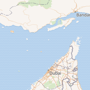
[edit]Abu Musa island is located 70 kilometres (43 mi) south of Bandar-e Shenas and 59 kilometres (37 mi) north-northwest of Sharjah. Out of the 14 islands of Hormozgan, it is the farthest from the Iranian coast. Its highest point is the 110-metre (360 ft) Mount Halva[11] and has Abu Musa city as the center of the island. The weather in Abu Musa is warm and humid, a better climate compared to other islands in the Persian Gulf. It has the most diverse ecosystem, but lacks suitable soil and water for farming. Fishing is the main industry for the locals.
It is served by the regional Abu Musa Airport.
History
[edit]
Since ancient and medieval times Abu Musa has been governed by different Iranian administrations (Achaemenids, Parthians, Sasanians, etc.). In 1971 the sovereignty of Iran on Abu Musa was disputed by UAE.[12][13] The island had been under the control of Qajar Iran (a semi-colony of the British Empire) and governed by the Al-Qasimi ruler of Sharjah.[14][15] In 1906 Salim bin Sultan, the uncle of Sharjah's ruler Saqr bin Khalid, awarded a concession for iron oxide deposits discovery in the island to three Arabs, whose workers extracted the mineral and agreed to sell it to Wonckhaus, a German enterprise. However, Saqr bin Khalid disagreed with the act and cancelled the grant. The workers were then removed from the island with assistance from the British, resulting in an international incident.[16][17]
After 1908, the UK controlled the island along with the other British-held islands in the Persian Gulf, including what is today the UAE. In the late 1960s, the UK transferred administration of the island to the British-appointed Sharjah, one of the seven sheikdoms that would later form the UAE.
After the UK announced in 1968 that it would end its administrative and military positions in the Persian Gulf, Iran moved to reattach the island politically to the mainland. On 30 November 1971 (two days before the official establishment of UAE), Iran and Sharjah signed a Memorandum of Understanding. They agreed to allow Sharjah to have a local police station and Iran to station troops on the island according to the map attached to the Memorandum of Understanding.[15] The agreement also divided the island's energy resources between the two signatories. "By agreeing to the pact, the tiny emirate prevented an invasion by Iran, which two days earlier had taken two other disputed islands, the Greater and Lesser Tunbs, which were even smaller and uninhabited."[18]

Iranian takeover
[edit]On 30 November 1971, a day before the UK officially left the region, Iran moved troops onto the island and were officially welcomed by the Sheik of Sharjah's brother, Sheik Saqer.[19]
UAE claim
[edit]The UAE took its sovereignty claim over Abu Musa and the two Tunb islands to a meeting of the United Nations Security Council of 9 December 1971. At that meeting, it was decided to "defer consideration of this matter to a later date".[20][21] Iraq (Ahmed Hassan al-Bakr era),[22] Kuwait,[23] Algeria,[24] South Yemen[24] and Libya[24] held the view that the territory rightfully belongs to the UAE.[25][26][27][28][29] Since that time, the UAE has consistently called in public statements[21][30] for either bilateral negotiations or by referring the issue to the International Court of Justice (or another form of international arbitration).[31]
Saddam Hussein attempted to justify the Iran–Iraq War by claiming that one of the objectives was to "liberate" Abu Musa and the Tunbs in the Persian Gulf. In 1992, Iran expelled "foreign" workers who operated the UAE-sponsored school, medical clinic, and power-generating station.[32] The dispute has also caused serious friction between Ras al-Khaimah and Sharjah on the one hand and some other emirates of the UAE on the other. Ras Al Khaimah advocates tough measures against Iran. Dubai, on the other hand, believes that the conflict is unnecessary. The present ruler of Dubai (who is also Vice President, Prime Minister and Defence Minister of the UAE), Mohammed bin Rashid Al Maktoum, has earlier stated publicly that "he believes the tensions over the islands have been fabricated by the United States".[33]
In 2012 a visit to the island by Iranian president Ahmedinejad provoked a diplomatic incident.[34] Iran's historical claim to ownership over the islands roots back to the Parthian and Sasanian Empires, among others.[35] Iran considers the island to have been occupied by the UK and refers to the agreement between Iran and the emirate of Sharjah in 1971.[15]
Demographics
[edit]As of 2012[update], the island had about 2,131 inhabitants, making it Iran's smallest county.[36] The city of Abu Musa had 1,953 inhabitants in 2012, up 248 from 2006.[37]
Most of the native residents of the island speak the "Bandari" dialect of Persian.
UAE citizens living on the island allegedly face "great difficulties" with the lack of proper clinics and schools. Only one school exists on the island,[38] and it is used by 150 students.[39] Moreover, patients have to be transported to Sharjah to receive treatment, but that is sometimes not feasible because of the Iranian authorities.[39] In addition, Iran allegedly delays or blocks UAE's school and medical supplies from entering the island.[39]
Climate
[edit]The island’s climate is hot and arid. Classified as BWh under Köppen climate classification. The Island has warm to hot weather throughout the year, with all months averaging above 20 °C (68 °F), almost all of the annual precipitation falls during the winter season.
| Climate data for Abu Musa Island (normals 1991-2020 extremes 1984-2020) | |||||||||||||
|---|---|---|---|---|---|---|---|---|---|---|---|---|---|
| Month | Jan | Feb | Mar | Apr | May | Jun | Jul | Aug | Sep | Oct | Nov | Dec | Year |
| Record high °C (°F) | 28.2 (82.8) |
30.0 (86.0) |
36.0 (96.8) |
39.6 (103.3) |
41.8 (107.2) |
42.0 (107.6) |
45.0 (113.0) |
42.6 (108.7) |
43.0 (109.4) |
43.0 (109.4) |
35.0 (95.0) |
30.6 (87.1) |
45.0 (113.0) |
| Mean daily maximum °C (°F) | 23.2 (73.8) |
23.7 (74.7) |
25.6 (78.1) |
29.0 (84.2) |
32.5 (90.5) |
34.8 (94.6) |
36.6 (97.9) |
37.0 (98.6) |
35.7 (96.3) |
33.4 (92.1) |
29.4 (84.9) |
25.5 (77.9) |
30.5 (87.0) |
| Daily mean °C (°F) | 21.3 (70.3) |
21.7 (71.1) |
23.4 (74.1) |
26.5 (79.7) |
30.0 (86.0) |
32.5 (90.5) |
34.2 (93.6) |
34.5 (94.1) |
33.2 (91.8) |
31.1 (88.0) |
27.3 (81.1) |
23.5 (74.3) |
28.3 (82.9) |
| Mean daily minimum °C (°F) | 18.3 (64.9) |
18.7 (65.7) |
20.4 (68.7) |
23.3 (73.9) |
26.7 (80.1) |
29.0 (84.2) |
30.9 (87.6) |
31.0 (87.8) |
29.5 (85.1) |
27.2 (81.0) |
23.8 (74.8) |
20.3 (68.5) |
24.9 (76.9) |
| Record low °C (°F) | 11.0 (51.8) |
8.0 (46.4) |
11.6 (52.9) |
15.8 (60.4) |
19.2 (66.6) |
23.0 (73.4) |
26.2 (79.2) |
26.2 (79.2) |
24.0 (75.2) |
19.0 (66.2) |
16.4 (61.5) |
11.0 (51.8) |
8.0 (46.4) |
| Average precipitation mm (inches) | 29.5 (1.16) |
14.1 (0.56) |
28.5 (1.12) |
4.2 (0.17) |
0.2 (0.01) |
0.0 (0.0) |
0.2 (0.01) |
0.0 (0.0) |
0.0 (0.0) |
1.6 (0.06) |
15.7 (0.62) |
29.0 (1.14) |
123 (4.85) |
| Average precipitation days (≥ 1.0 mm) | 2.6 | 1.6 | 2.4 | 0.7 | 0.1 | 0.0 | 0.0 | 0.0 | 0.0 | 0.1 | 1.3 | 2.2 | 11 |
| Average relative humidity (%) | 60 | 64 | 69 | 70 | 72 | 73 | 70 | 69 | 68 | 64 | 58 | 60 | 66 |
| Average dew point °C (°F) | 13.0 (55.4) |
14.4 (57.9) |
17.0 (62.6) |
20.4 (68.7) |
24.1 (75.4) |
26.8 (80.2) |
27.8 (82.0) |
27.7 (81.9) |
26.4 (79.5) |
23.2 (73.8) |
18.0 (64.4) |
15.0 (59.0) |
21.2 (70.1) |
| Mean monthly sunshine hours | 232 | 223 | 233 | 264 | 313 | 310 | 281 | 291 | 277 | 290 | 258 | 237 | 3,209 |
| Average ultraviolet index | 6 | 6 | 6 | 7 | 8 | 8 | 8 | 8 | 8 | 7 | 7 | 6 | 7 |
| Source 1: NOAA NCEI[40] | |||||||||||||
| Source 2: IRIMO(extremes)[41] Weather atlas(UV)[42] | |||||||||||||
| Climate data for Jazireh Abu Musa (1984–2010) | |||||||||||||
|---|---|---|---|---|---|---|---|---|---|---|---|---|---|
| Month | Jan | Feb | Mar | Apr | May | Jun | Jul | Aug | Sep | Oct | Nov | Dec | Year |
| Record high °C (°F) | 27.8 (82.0) |
29.5 (85.1) |
36.0 (96.8) |
39.6 (103.3) |
41.8 (107.2) |
42.0 (107.6) |
45.0 (113.0) |
41.4 (106.5) |
43.0 (109.4) |
43.0 (109.4) |
35.0 (95.0) |
30.0 (86.0) |
45.0 (113.0) |
| Mean daily maximum °C (°F) | 23.0 (73.4) |
23.9 (75.0) |
25.5 (77.9) |
28.9 (84.0) |
32.5 (90.5) |
34.5 (94.1) |
36.3 (97.3) |
36.7 (98.1) |
35.4 (95.7) |
33.2 (91.8) |
29.6 (85.3) |
25.4 (77.7) |
30.4 (86.7) |
| Daily mean °C (°F) | 20.5 (68.9) |
21.0 (69.8) |
22.9 (73.2) |
26.0 (78.8) |
29.5 (85.1) |
31.6 (88.9) |
33.5 (92.3) |
33.7 (92.7) |
32.3 (90.1) |
30.0 (86.0) |
26.6 (79.9) |
22.7 (72.9) |
27.5 (81.6) |
| Mean daily minimum °C (°F) | 18.0 (64.4) |
18.5 (65.3) |
20.3 (68.5) |
23.1 (73.6) |
26.5 (79.7) |
28.8 (83.8) |
30.6 (87.1) |
30.8 (87.4) |
29.2 (84.6) |
26.8 (80.2) |
23.7 (74.7) |
20.0 (68.0) |
24.7 (76.4) |
| Record low °C (°F) | 11.0 (51.8) |
8.0 (46.4) |
11.6 (52.9) |
15.8 (60.4) |
19.2 (66.6) |
23.4 (74.1) |
26.2 (79.2) |
26.8 (80.2) |
24.0 (75.2) |
19.0 (66.2) |
17.0 (62.6) |
11.0 (51.8) |
8.0 (46.4) |
| Average precipitation mm (inches) | 30.0 (1.18) |
20.1 (0.79) |
28.1 (1.11) |
6.8 (0.27) |
0.0 (0.0) |
0.0 (0.0) |
0.2 (0.01) |
0.0 (0.0) |
0.0 (0.0) |
1.6 (0.06) |
5.8 (0.23) |
33.7 (1.33) |
126.3 (4.98) |
| Average precipitation days (≥ 1.0 mm) | 2.4 | 1.9 | 2.3 | 0.7 | 0.0 | 0.0 | 0.0 | 0.0 | 0.0 | 0.1 | 0.8 | 2.8 | 11.0 |
| Average relative humidity (%) | 61 | 66 | 69 | 71 | 72 | 74 | 71 | 70 | 69 | 65 | 60 | 62 | 68 |
| Mean monthly sunshine hours | 227.4 | 225.9 | 231.6 | 267.4 | 312.4 | 315.8 | 284.7 | 294.5 | 280.5 | 293.9 | 263.4 | 228.9 | 3,226.4 |
| Source: Iran Meteorological Organization (records),[41] (temperatures),[43] (precipitation),[44] (humidity),[45] (days with precipitation),[46]
(sunshine)[47] | |||||||||||||
See also
[edit]- Iran–United Arab Emirates relations
- Seizure of Abu Musa and the Greater and Lesser Tunbs
- Sir Abu Nu'ayr
- List of lighthouses in Iran
References
[edit]- ^ Rowlett, Russ. "Lighthouses of Iran". The Lighthouse Directory. University of North Carolina at Chapel Hill. Retrieved 3 October 2016.
- ^ NGA List of Lights – Pub.112 Archived 21 October 2016 at the Wayback Machine Retrieved 3 October 2016
- ^ Iranian Islands of Tunbs and Abu Musa Archived 23 September 2006 at the Wayback Machine
- ^ Ewan W. Anderson; Gareth Owen (1993). An atlas of world political flashpoints: a sourcebook of geopolitical crisis. Pinter Reference. p. 1. ISBN 978-1-85567-053-2. Archived from the original on 30 May 2016. Retrieved 19 February 2016.
- ^ Fred M. Shelley (30 April 2013). Nation Shapes: The Story Behind the World's Borders. ABC-CLIO. pp. 457–. ISBN 978-1-61069-106-2. Archived from the original on 30 May 2016. Retrieved 19 February 2016.
- ^ Ibrahim Abed; Peter Hellyer (2001). United Arab Emirates: A New Perspective. Trident Press Ltd. pp. 182–. ISBN 978-1-900724-47-0. Archived from the original on 30 May 2016.
Iran claims Abu Musa Territorial and political ambitions, combined with the economic interests of influential elements within the government, helped strengthen the first Iranian claim to the island of Abu Musa in 1904. Iran began to challenge ...
- ^ "Ajam, Muḥammad. "Documents on the Persian Gulf's name: The eternal heritage of ancient time". Tehran: Evin Publication, 2009". Archived from the original on 11 September 2012.
- ^ "اسناد نام خلیج [فارس]؛ میراثی کهن و جاودان". opac.nlai.ir. Archived from the original on 7 April 2014. Retrieved 22 April 2012.
- ^ "النظام الإيراني المحتل يمارس الغطرسة ضد سكان الجزر الإماراتية". Al Riyadh. No. 17360. 4 January 2016. Archived from the original on 31 July 2017. Retrieved 11 July 2017.
- ^ سيستاني, ايرج افشار. جزيرة بوموسى وطنب بزرك وطنب كوجك.
- ^ Pirouz Mojtahed-Zadeh (January 2007). Boundary Politics and International Boundaries of Iran: A Study of the Origin, Evolution, and Implications of the Boundaries of Modern Iran with Its 1. Universal-Publishers. pp. 305–. ISBN 978-1-58112-933-5. Archived from the original on 30 May 2016. Retrieved 19 February 2016.
- ^ "Abu Musa and The Tumbs: The Dispute That Won't Go Away, Part Two". The Estimate. Vol. XIII, no. 13. 24 July 2001. Archived from the original on 15 December 2007. Retrieved 6 January 2008.
{{cite news}}: CS1 maint: unfit URL (link) - ^ Henderson, Simon (7 December 2007). "Unwanted Guest: The Gulf Summit and Iran". Archived from the original on 23 January 2021. Retrieved 23 January 2021.
- ^ Ahmadi, Kourosh (2008). Islands and International Politics in the Persian Gulf: The Abu Musa and Tunbs in Strategic Context. Routledge. p. 54. ISBN 978-0-415-45933-4.
- ^ a b c Mojtahedzadeh, Pirouz (1993). Countries and boundaries in the geopolitical region of the Persian Gulf (in Persian). The Institute for Political and International Studies. OCLC 651081387.
- ^ Issawi, Charles (1991). "European Economic Penetration, 1872–1921". In Avery, Peter; Hambly, Gavin; Melville, Charles (eds.). The Cambridge History of Iran. Cambridge University Press. p. 605. ISBN 978-0-521-20095-0.
- ^ Laithwaite, John Gilbert (1934). "Red oxide on Abu Musa, 1898-1934". British Library: India Office Records and Private Papers. IOR/L/PS/18/B433 – via Qatar Digital Library.
- ^ Erdbrink, Thomas (30 April 2012). "A Tiny Island Is Where Iran Makes a Stand". The New York Times. Archived from the original on 5 May 2017. Retrieved 26 February 2017.
- ^ Mojtahedzadeh, Pirouz (1999). Security and territoriality in the Persian Gulf. London: RoutledgeCurzon. p. 214. ISBN 0-7007-1098-1.
- ^ Mattair, Thomas (2005). The Three Occupied Islands of the UAE: The Tunbs and Abu Musa. Abu Dhabi: Emirates Center for Strategic Studies and Research. ISBN 9948-00-765-4.
- ^ a b United Nations (1971). "Twenty-sixth Year, Supplement for October, November and December 1971". Official Records of the Security Council. Archived from the original on 20 February 2014. Retrieved 13 March 2013.
- ^ United Nations Security Council (1972). Letter dated 72/07/17 from the representatives of Algeria, Bahrain, Egypt, Iraq, Kuwait, Lebanon, the Libyan Arab Republic, Morocco, Oman, the People's Democratic Republic of Yemen, Sudan, The Syrian Arab Republic, Tunisia, the United Arab Emirates and Yemen to the President of the Security Council (PDF). New York: United Nations Supplement, Official Record. UNDOC:S/10740. Archived (PDF) from the original on 9 June 2014. Retrieved 13 March 2013.
- ^ United Nations Security Council (1992). Letter dated 92/09/14 from the Permanent Representative of Kuwait to the United Nations addressed to the Secretary-General. New York: United Nations Annexes, Official Record. UNDOC: A/47/441. Archived from the original on 20 February 2014. Retrieved 13 March 2013.
- ^ a b c United Nations Security Council (1971). Letter dated 71/12/03 from the representatives of Algeria, Iraq, the Libyan Arab Republic and the People's Democratic Republic of Yemen to the President of the Security Council. New York: United Nations Supplement, Official Record. UNDOC:S/10409. Archived from the original on 9 June 2014. Retrieved 13 March 2013.
- ^ United Nations Security Council (December 1994). Letter dated 94/12/22 from the Permanent Representative of Bahrain to the United Nations addressed to the Secretary-General (PDF). New York: United Nations Annexes, Official Record. UNDOC: A/49/815. Archived (PDF) from the original on 9 June 2014. Retrieved 13 March 2013.
- ^ United Nations Security Council (1993). Letter dated 93/10/13 from the representative of Saudi Arabia to the United Nations addressed to the President of the General Assembly. New York: United Nations Annexes, Official Record. UNDOC: A/48/519. Archived from the original on 9 June 2014. Retrieved 13 March 2013.
- ^ United Nations Security Council (September 1994). Letter dated 94/09/20 from the Permanent Representative of Saudi Arabia to the United Nations addressed to the Secretary-General (PDF). New York: United Nations Annexes, Official Record. UN DOC: A/49/412 S/1994/1078. Archived (PDF) from the original on 9 June 2014. Retrieved 13 March 2013.
- ^ United Nations Security Council (June 1995). Letter dated 95/06/21 from the Permanent Representative of Bahrain to the United Nations addressed to the Secretary-General (PDF). New York: United Nations Annexes, Official Record. Archived (PDF) from the original on 9 June 2014. Retrieved 13 March 2013.
- ^ United Nations Security Council (October 1992). Letter dated 92/10/06 from the Permanent Representative of Oman to the United Nations addressed to the President of the General Assembly (PDF). New York: United Nations Annexes, Official Record. UNDOC: A/47/516. Archived (PDF) from the original on 9 June 2014. Retrieved 13 March 2013.
- ^ United Nations (17 September 1997). "Letter dated 16 September 1997 from the Permanent Representative of the United Arab Emirates to the United Nations addressed to the Secretary-General" (PDF). United Nations General Assembly. Oceans and the Law of the Sea. 52nd Session. Archived (PDF) from the original on 9 June 2014. Retrieved 13 March 2013.
- ^ Mattair, Thomas (2005). The Three Occupied Islands of the UAE: The Tunbs and Abu Musa. Abu Dhabi: Emirates Center for Strategic Studies and Research. pp. 165–166. ISBN 9948-00-765-4.
- ^ Pike, John. "Abu Musa Island – Iran Special Weapons Facilities". globalsecurity.org. Archived from the original on 26 December 2010. Retrieved 31 July 2006.
- ^ Rubin, Barry M. (2002). Crises in the Contemporary Persian Gulf. Routledge. pp. 44–45. ISBN 978-0-7146-5267-2.
- ^ "Ahmadinejad's visit to island prompts UAE to recall Iran ambassador". CNN. 12 April 2012. Archived from the original on 12 April 2012. Retrieved 12 April 2012.
- ^ "Fars Library". Archived from the original on 11 July 2012. Retrieved 19 April 2012.
- ^ "Archived copy". Retrieved 22 June 2011.[dead link]
- ^ "Archived copy". Retrieved 27 January 2010.[dead link]
- ^ الأمير, نورا (2 February 2017). ""التربية" تفتح باب نقل المعلمين إلى مدرسة أبو موسى". Al Bayan (in Arabic). Archived from the original on 3 January 2019. Retrieved 2 January 2019.
- ^ a b c Ashor, Ahmed (22 April 2010). "إماراتيّون في "أبوموسى" يعيشون حياة بدائية تحت الاحتلال" [Emiratis in Abu Musa live a primitive life under occupation]. Emarat Al Youm (in Arabic). Archived from the original on 1 August 2018. Retrieved 7 July 2017.
- ^ "World Meteorological Organization Climate Normals for 1991-2020: Abumusa Island" (CSV). ncei.noaa.gov. NOAA. Retrieved 27 January 2024.
- ^ a b *"Highest record temperature in Jazireh Abu Musa by Month 1984–2010". Iran Meteorological Organization. Archived from the original on 5 November 2016. Retrieved 8 April 2015.
- "Lowest record temperature in Jazireh Abu Musa by Month 1984–2010". Iran Meteorological Organization. Archived from the original on 5 November 2016. Retrieved 8 April 2015.
- ^ "Climate and monthly weather forecast Abu Musa, Iran". Weather Atlas. Retrieved 27 January 2024.
- ^ *"Average Maximum temperature in Jazireh Abu Musa by Month 1984–2010". Iran Meteorological Organization. Retrieved 8 April 2015.[permanent dead link]
- "Average Mean Daily temperature in Jazireh Abu Musa by Month 1984–2010". Iran Meteorological Organization. Archived from the original on 19 April 2017. Retrieved 8 April 2015.
- "Average Minimum temperature in Jazireh Abu Musa by Month 1984–2010". Iran Meteorological Organization. Archived from the original on 9 May 2016. Retrieved 8 April 2015.
- ^ "Monthly Total Precipitation in Jazireh Abu Musa by Month 1984–2010". Iran Meteorological Organization. Archived from the original on 7 October 2017. Retrieved 8 April 2015.
- ^ "Average relative humidity in Jazireh Abu Musa by Month 1984–2010". Iran Meteorological Organization. Retrieved 8 April 2015.[permanent dead link]
- ^ "No. Of days with precipitation equal to or greater than 1 mm in Jazireh Abu Musa by Month 1984–2010". Iran Meteorological Organization. Archived from the original on 9 May 2016. Retrieved 8 April 2015.
- ^ "Monthly total sunshine hours in Jazireh Abu Musa by Month 1984–2010". Iran Meteorological Organization. Archived from the original on 9 May 2016. Retrieved 8 April 2015.
Sources
[edit]- Haghshenas, Seyeed Ali, Iran Historical Sovereignty over the Tunbs and BuMusa Islands. 2010, Tehran.
Further reading
[edit]- Schofield, Richard (2003). Unfinished Business: Iran, the Uae, Abu Musa and the Tunbs. London: Royal Institute of International Affairs. ISBN 0-905031-90-3.
External links
[edit]![]() Media related to Abu Musa Island at Wikimedia Commons
Media related to Abu Musa Island at Wikimedia Commons
- "ABU MUSĀ" at Encyclopædia Iranica
- History, description, map of Abu Musa and nearby islands (Archived 2009-10-24)
- History of Abu Musa and The Tunbs
- UAE Interact Abu Musa News
- Abu Musa's military garrison
- Dispute between Iran and Sharjah
- Report of the International symposium on Modern Boundaries of Iran – Problems and practices of Iranian boundaries Archived 27 August 2019 at the Wayback Machine, Pirouz Mojtahed-Zadeh, 10/15/02
- Picture of Abu Musa Lighthouse
25°52′N 55°02′E / 25.867°N 55.033°E
Hormozgan Province, Iran | |||||||||||||||||||||||||
|---|---|---|---|---|---|---|---|---|---|---|---|---|---|---|---|---|---|---|---|---|---|---|---|---|---|
| Capital |  | ||||||||||||||||||||||||
| Counties and cities |
| ||||||||||||||||||||||||
| Sights |
| ||||||||||||||||||||||||
| populated places | |||||||||||||||||||||||||
| See also | |||||||||||||||||||||||||
| International | |
|---|---|
| National | |
| Abu Musa Lighthouse | |