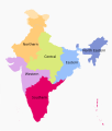
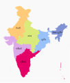
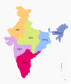
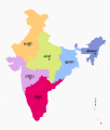
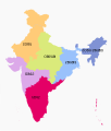
File:Zonal Councils.svg
Appearance

Size of this PNG preview of this SVG file: 511 × 599 pixels. Other resolutions: 205 × 240 pixels | 410 × 480 pixels | 655 × 768 pixels | 874 × 1,024 pixels | 1,748 × 2,048 pixels | 1,594 × 1,868 pixels.
Original file (SVG file, nominally 1,594 × 1,868 pixels, file size: 226 KB)
File history
Click on a date/time to view the file as it appeared at that time.
| Date/Time | Thumbnail | Dimensions | User | Comment | |
|---|---|---|---|---|---|
| current | 09:41, 27 May 2022 |  | 1,594 × 1,868 (226 KB) | Jiaminglimjm | File uploaded using svgtranslate tool (https://svgtranslate.toolforge.org/). Added translation for id. |
| 17:47, 15 November 2020 |  | 1,594 × 1,868 (226 KB) | Sbb1413 | Marked the areas claimed by India but occupied by other countries. | |
| 17:49, 9 November 2020 |  | 1,594 × 1,868 (226 KB) | Sbb1413 | Andaman and Lakshadweep are invitees to the Southern Zone. | |
| 15:31, 26 April 2018 |  | 1,594 × 1,868 (226 KB) | फ़िलप्रो | Delhi is actually in the Northern Zonal Council | |
| 06:04, 16 April 2017 |  | 1,594 × 1,868 (226 KB) | फ़िलप्रो | more fixes | |
| 01:13, 14 April 2017 |  | 1,594 × 1,868 (226 KB) | फ़िलप्रो | Fixed as per https://web.archive.org/web/20120508170915/http://interstatecouncil.nic.in/zonal.htm | |
| 22:51, 19 September 2016 |  | 1,594 × 1,868 (226 KB) | फ़िलप्रो | User created page with UploadWizard |
File usage
The following 9 pages use this file:
Global file usage
The following other wikis use this file:
- Usage on ar.wikipedia.org
- Usage on ban.wikipedia.org
- Usage on el.wikipedia.org
- Usage on es.wikipedia.org
- Usage on eu.wikipedia.org
- Usage on fr.wikipedia.org
- Usage on he.wikipedia.org
- Usage on id.wikipedia.org
- Usage on ja.wikipedia.org
- Usage on ka.wikipedia.org
- Usage on ko.wikipedia.org
- Usage on ml.wikipedia.org
- Usage on ms.wikipedia.org
- Usage on my.wikipedia.org
- Usage on ne.wikipedia.org
- Usage on ta.wikipedia.org
- Usage on te.wikipedia.org
View more global usage of this file.

