| PMC full text: | Published online 2019 May 17. doi: 10.1186/s12985-019-1176-y
|
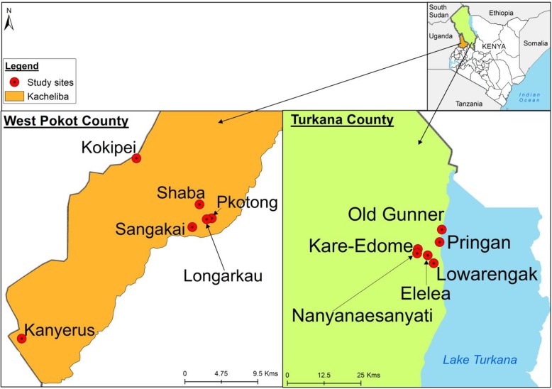
Fig. 1

Map of Kenya showing the study sites in West Pokot and Turkana Counties. This map was generated specifically for this manuscript by icipe GIS team and does not infringe on copyright issues. The sample points were collected using a GPS gadget (garmin etrex 20, https://buy.garmin.com/en-US/US/p/518046), and the county boundaries for Kenya derived from AfricaOpendata (https://africaopendata.org/dataset/kenya-counties-shapefile, license Creative Commons)


