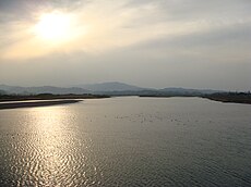
Category:Naka River (Tokushima)
Jump to navigation
Jump to search
Nederlands: De Naka is een 125 km lange rivier die stroomt in de Japanse prefectuur Tokushima.
river in Tokushima, Japan | |||||
| Upload media | |||||
| Instance of | |||||
|---|---|---|---|---|---|
| Named after | |||||
| Location | Tokushima Prefecture, Japan | ||||
| Length |
| ||||
| Origin of the watercourse | |||||
| Mouth of the watercourse | |||||
| Drainage basin |
| ||||
| Tributary |
| ||||
 | |||||
Subcategories
This category has the following 4 subcategories, out of 4 total.
Media in category "Naka River (Tokushima)"
The following 21 files are in this category, out of 21 total.
-
Beardedseal nakachang nakagawa tokushima.jpg 945 × 716; 565 KB
-
Hanouratown Myoken 小須賀 Anancity Tokushimapref Naka river.JPG 640 × 480; 69 KB
-
Hosonotown 長手 Anancity Tokushimapref Naka river.jpg 1,280 × 960; 280 KB
-
Kamionotown Anancity Tokushimapref Naka river.JPG 2,304 × 1,536; 1.54 MB
-
Kamodani bridge.jpg 1,280 × 960; 278 KB
-
Mitinoeki nakagawa01.JPG 2,048 × 1,360; 1.73 MB
-
Nakagawa in tokushima 01.JPG 2,048 × 1,360; 2.06 MB
-
Niu 王子前 Nakatown Tokushimapref Naka river.jpg 1,280 × 960; 243 KB
-
Niudani bridge in Route 195 No,2.jpg 1,280 × 960; 257 KB
-
Niudani bridge in Route 195.jpg 1,280 × 960; 213 KB
-
Oitown 東平 Anancity Tokushimapref Naka river.jpg 1,280 × 960; 268 KB
-
The end of nakagawa river - 那賀川河口 - panoramio (1).jpg 4,912 × 3,264; 3.94 MB
-
The end of nakagawa river - 那賀川河口 - panoramio (3).jpg 4,912 × 3,264; 3.22 MB
-
The end of nakagawa river - 那賀川河口 - panoramio.jpg 4,912 × 3,264; 3.03 MB
-
Wajiki 郷田野 Nakatown Tokushimapref Naka river.jpg 1,280 × 960; 267 KB
-
Yoshiitown 中洲 Anancity Tokushimapref Naka river.JPG 2,304 × 1,536; 1.44 MB
-
Yoshitown 地神北 Anancity Tokushimapref Naka river.jpg 1,280 × 960; 251 KB
-
あぶヶ淵 - panoramio.jpg 2,164 × 1,143; 865 KB
-
那賀川の夕暮れ - panoramio.jpg 2,138 × 1,489; 581 KB
-
那賀川(徳島県阿南市).JPG 3,264 × 2,448; 2.18 MB
-
鷲敷ライン - panoramio.jpg 1,461 × 2,053; 1.02 MB


