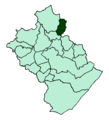
Category:Verbandsgemeinde Thalfang am Erbeskopf
Jump to navigation
Jump to search
Verbandsgemeinde in Rhineland-Palatinate | |||||
| Upload media | |||||
| Instance of |
| ||||
|---|---|---|---|---|---|
| Location | Bernkastel-Wittlich, Rhineland-Palatinate, Germany | ||||
| official website | |||||
 | |||||
Subcategories
This category has the following 22 subcategories, out of 22 total.
Media in category "Verbandsgemeinde Thalfang am Erbeskopf"
The following 25 files are in this category, out of 25 total.
-
Berglicht-karte-vg-thalfang-erbeskopf.png 444 × 487; 9 KB
-
Breit-karte-vg-thalfang-erbeskopf.png 444 × 487; 9 KB
-
Buedlich-karte-vg-thalfang-erbeskopf.png 444 × 487; 9 KB
-
Burtscheid-karte-vg-thalfang-erbeskopf.png 444 × 487; 9 KB
-
Deuselbach-karte-vg-thalfang-erbeskopf.png 444 × 487; 9 KB
-
Dhronecken-karte-vg-thalfang-erbeskopf.png 444 × 487; 9 KB
-
Etgert-karte-vg-thalfang-erbeskopf.png 444 × 487; 9 KB
-
Flagge VG Thalfang am Erbeskopf.gif 216 × 540; 7 KB
-
Gielert-karte-vg-thalfang-erbeskopf.png 444 × 487; 9 KB
-
Graefendhron-karte-vg-thalfang-erbeskopf.png 444 × 487; 9 KB
-
Heidenburg-karte-vg-thalfang-erbeskopf.png 444 × 487; 9 KB
-
Hilscheid-karte-vg-thalfang-erbeskopf.png 444 × 487; 9 KB
-
Horath-karte-vg-thalfang-erbeskopf.png 444 × 487; 9 KB
-
Immert-karte-vg-thalfang-erbeskopf.png 444 × 487; 9 KB
-
Karte-vg-thalfang-erbeskopf.png 444 × 487; 9 KB
-
Lueckenburg-karte-vg-thalfang-erbeskopf.png 444 × 487; 9 KB
-
Malborn-karte-vg-thalfang-erbeskopf.png 444 × 487; 9 KB
-
Vg-thalfang-landkreis-bernkastel-wittlich-map.png 468 × 475; 9 KB
-
Mark-thalfang-Karte-vg-thalfang-erbeskopf.png 444 × 487; 9 KB
-
Merschbach-karte-vg-thalfang-erbeskopf.png 444 × 487; 9 KB
-
Neunkirchen-karte-vg-thalfang-erbeskopf.png 444 × 487; 9 KB
-
Rorodt-karte-vg-thalfang-erbeskopf.png 444 × 487; 9 KB
-
Schoenberg-karte-vg-thalfang-erbeskopf.png 444 × 487; 9 KB
-
Talling-karte-vg-thalfang-erbeskopf.png 444 × 487; 9 KB
-
Thalfang-karte-vg-thalfang-erbeskopf.png 444 × 487; 9 KB


