User:Omar-toons
Jump to navigation
Jump to search
Formerly Omar-Toons (contribs · uploads)
|
|
|
(mostly in French)
Historical maps of Morocco
-
Idrisid era - Maximal extension
(available in English) -
Almoravid era - Maximal extension -
Almohad era - Maximal extension -
Marinid era - Variations -
Saadian era - Maximal extension -
Alaouite era - Maximal extension
-
Wattasid era - Simplified map -
Portuguese possessions in Morocco, XVI-XVIII century -
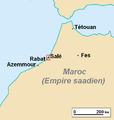
Republic of Salé - Localization
(available in English) -
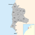
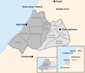
Republic of Salé - Detailed map -
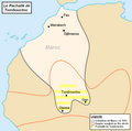
Pashalik of Timbuktu
(Background map)
-
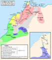
Morocco and the Maghreb after the Berber Revolt -
The Barghwata realm - Maximal extension -
Phases of the expansion of the Almohad state
(available in English) -
Saadian conquests - XVI century
Historical maps of Tunisia : the Zirid era
Ethno-linguistic maps of Morocco
-
Central Tamazight speaking areas
(available in English) -
Ghomara tribes -
Tekna's territory -
Jebala tribes -
Hahha tribes -
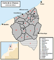
Chaouïa tribes -
Doukkala tribes -
Linguistic map of Morocco -
Ait Baamrane tribal confederacy
Beck schemes
-
Casablanca, global, 2013 -
Casablanca, global, 2030 -
Rabat, Tramway & rail, 2013 -
Casablanca - T1 -
Morocco, TNR rail network -
Casablanca, M1
(detailed) -
Casablanca, R1
(detailed) -
Casablanca, Al-Bidaoui/R2 -
Casablanca, RER, 2030


