| dbo:Infrastructure/length
| |
| dbo:abstract
|
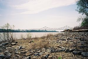
- The Cairo Mississippi River Bridge is a type of cantilever bridge known as a Steel Truss Through Deck carrying U.S. Route 60 and U.S. Route 62 across the Mississippi River. Located in the tri-state area of Illinois, Kentucky, and Missouri, it connects Cairo, Illinois at its northern terminus to Bird's Point, Missouri at its southern terminus. The bridge was most recently closed for renovation from March 16, 2015 to October 13, 2015. The bridge measures 5,175.5 feet (1,577.5 meters) in length with a main span of 700.9 feet (213.6 meters) and a width of 20 feet (6.1 meters). At its apex, the bridge stands 114 feet (35 meters) above the river with a 675-foot (206-meter) navigation channel and a river depth of 279 feet (85 meters). (en)
|
| dbo:bridgeCarries
| |
| dbo:crosses
| |
| dbo:length
| |
| dbo:locatedInArea
| |
| dbo:mainspan
| |
| dbo:maintainedBy
| |
| dbo:openingYear
| |
| dbo:thumbnail
| |
| dbo:type
| |
| dbo:width
| |
| dbo:wikiPageID
| |
| dbo:wikiPageLength
|
- 12438 (xsd:nonNegativeInteger)
|
| dbo:wikiPageRevisionID
| |
| dbo:wikiPageWikiLink
| |
| dbp:below
| |
| dbp:bridge
|
- Cairo Mississippi River Bridge (en)
|
| dbp:bridgeName
|
- Cairo Mississippi River Bridge (en)
|
| dbp:bridgeSigns
| |
| dbp:carries
| |
| dbp:crosses
| |
| dbp:design
| |
| dbp:downstream
| |
| dbp:id
| |
| dbp:imageSize
| |
| dbp:length
| |
| dbp:locale
|
- Bird's Point, Missouri and Cairo, Illinois (en)
|
| dbp:mainspan
| |
| dbp:maint
| |
| dbp:name
|
- Cairo Mississippi River Bridge (en)
|
| dbp:open
| |
| dbp:place
| |
| dbp:structure
| |
| dbp:upstream
| |
| dbp:upstreamSigns
| |
| dbp:width
| |
| dbp:wikiPageUsesTemplate
| |
| dbp:wordnet_type
| |
| dct:subject
| |
| gold:hypernym
| |
| georss:point
|
- 36.978611111111114 -89.14777777777778
|
| rdf:type
| |
| rdfs:comment
|
- The Cairo Mississippi River Bridge is a type of cantilever bridge known as a Steel Truss Through Deck carrying U.S. Route 60 and U.S. Route 62 across the Mississippi River. Located in the tri-state area of Illinois, Kentucky, and Missouri, it connects Cairo, Illinois at its northern terminus to Bird's Point, Missouri at its southern terminus. The bridge was most recently closed for renovation from March 16, 2015 to October 13, 2015. (en)
|
| rdfs:label
|
- Cairo Mississippi River Bridge (en)
|
| owl:differentFrom
| |
| owl:sameAs
| |
| geo:geometry
|
- POINT(-89.14778137207 36.978610992432)
|
| geo:lat
| |
| geo:long
| |
| prov:wasDerivedFrom
| |
| foaf:depiction
| |
| foaf:isPrimaryTopicOf
| |
| foaf:name
|
- Cairo Mississippi River Bridge (en)
|
| is dbo:wikiPageWikiLink
of | |
| is dbp:bridge
of | |
| is dbp:downstream
of | |
| is dbp:upstream
of | |
| is owl:differentFrom
of | |
| is foaf:primaryTopic
of | |


